Cairo, Johannesburg, Mumbai - 24 hrs Google Buzz and location-based information pops up everywhere
In this blog post, I will dive into the latest buzz: Google Buzz.
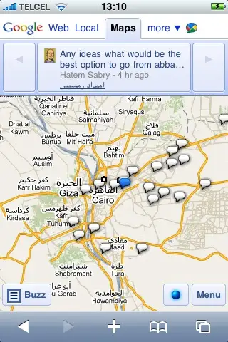
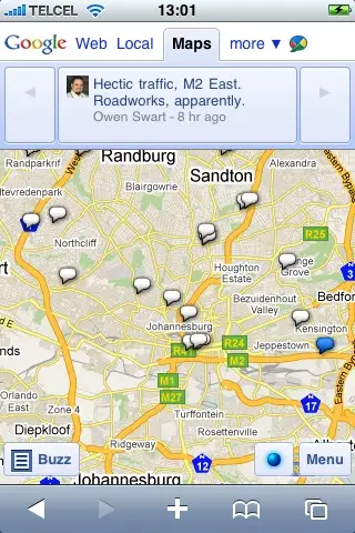
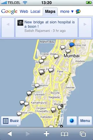
Google Buzz is a huge jump in location-based services as it happens all around the world at once. I have browsed through the map of Google Buzz' mobile phone version, where statuses can be combined with your location – it is striking to see where all information pops up. Here are maps of three different cities – Johannesburg, Cairo and Mumbai – showing messages from the last 24 hours.
So, basically, you can now zoom down to any location worldwide and take a look at what is happening or not there. It is just a matter of time before we see hundreds or thousands of updates from many places and at least a few from others. How would that information look like? Would it be only status updates or really helpful and critical information for activism, open intelligence or disaster relief?
Patrick Meier wrote the other day about the role of location based mobile alerts for disaster response in Haiti. He described how mobile and location based-services can really make a difference in disaster relief. GeoChat by InSTEDD was made for such a context and has some interesting overlapping with Google Buzz. The difference is that soon millions of people will use Google Buzz feeding information for all kinds of events and these can be located. A privacy nightmare, but a potential for activism and the nonprofit arena?
Location-based services can be great for coordination efforts. It basically is a powerful tool now in the hands of everybody, formerly not affordable. Nevertheless Google Buzz also allows exact surveillance of their users. Therefore such location-based services have to be used wit care. Gowalla or Brightkite offer similar services, but with one roll-out Google reaches 170 millions users from all around the world. Also Twitter has included location-based tweets recently.
Nevertheless, it might be better for reasons of privacy, security and data ownership to stay with existing open source solutions. But for some type of services such as traffic information, you need sufficient (massive) and reliable data. Google offers traffic information as another layer in its mobile application.
How can such data be best analyzed and used for different purposes? To analyze this information can become quite tricky. The Swift River project by the Ushahidi team is doing here some interesting work. Google Buzz has an API (Application Progamming Interface), so I imagine it is possible to analyze the information around certain events or locations. It has some interesting offerings and I am curious about how their open data standards can be used for the nonprofit world. Let's see how fast it will be adopted around the world and how it will be used.